1

Exploring the Majestic Monviso: A Three-Day Adventure

Nestled in the heart of the Italian Alps lies a hidden gem, the majestic Monviso. With a rich history, stunning natural beauty, and challenging trails, a tour of Monviso promises an unforgettable adventure.
this three-day expedition was nothing short of epic, filled with stunning natural beauty, a dash of history, and a lot of fun with friends.

Monviso: Where Magic Happens

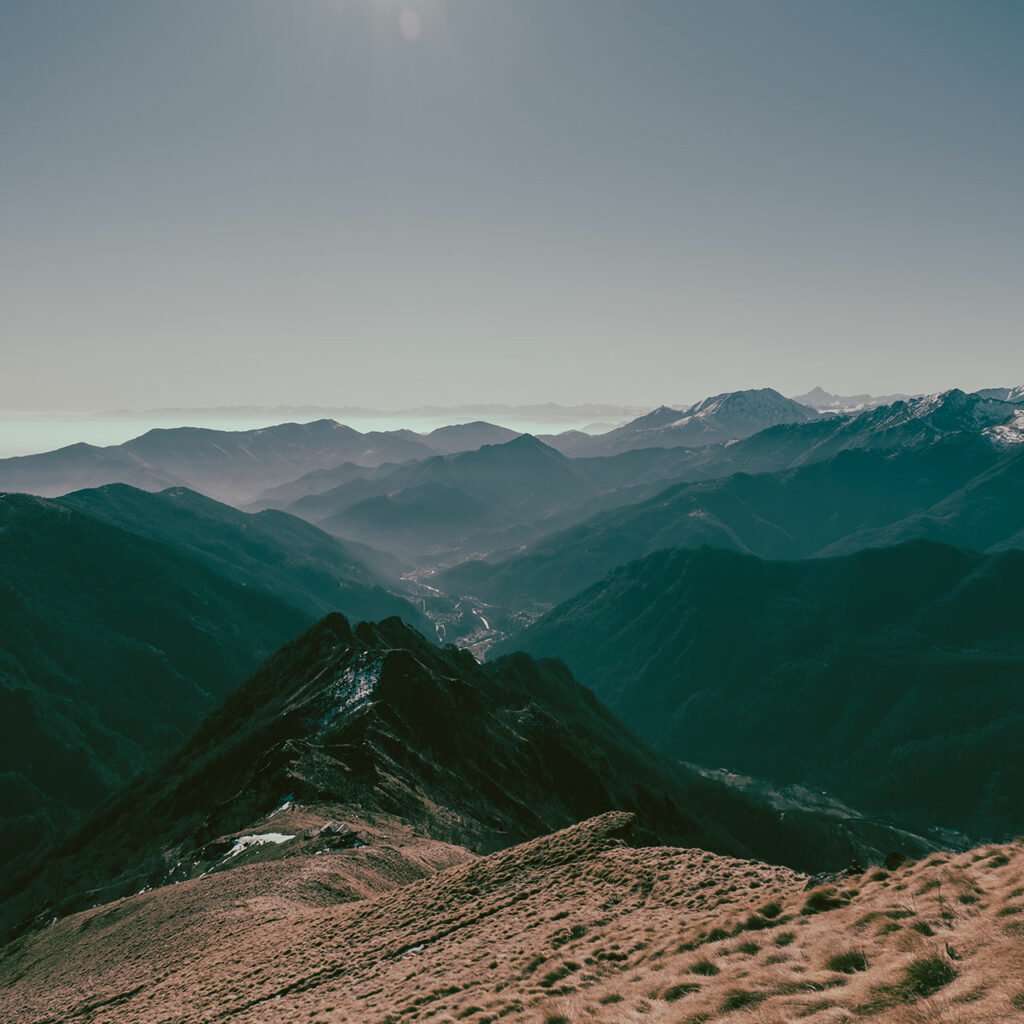
Monviso, affectionately known as Monte Viso, is a superstar mountain that proudly straddles the Italy-France border. Its unique pyramid shape has earned it the nickname “Mountain with a face,” and boy, is it photogenic! But Monviso is not just about its looks; it’s steeped in history and natural wonders.

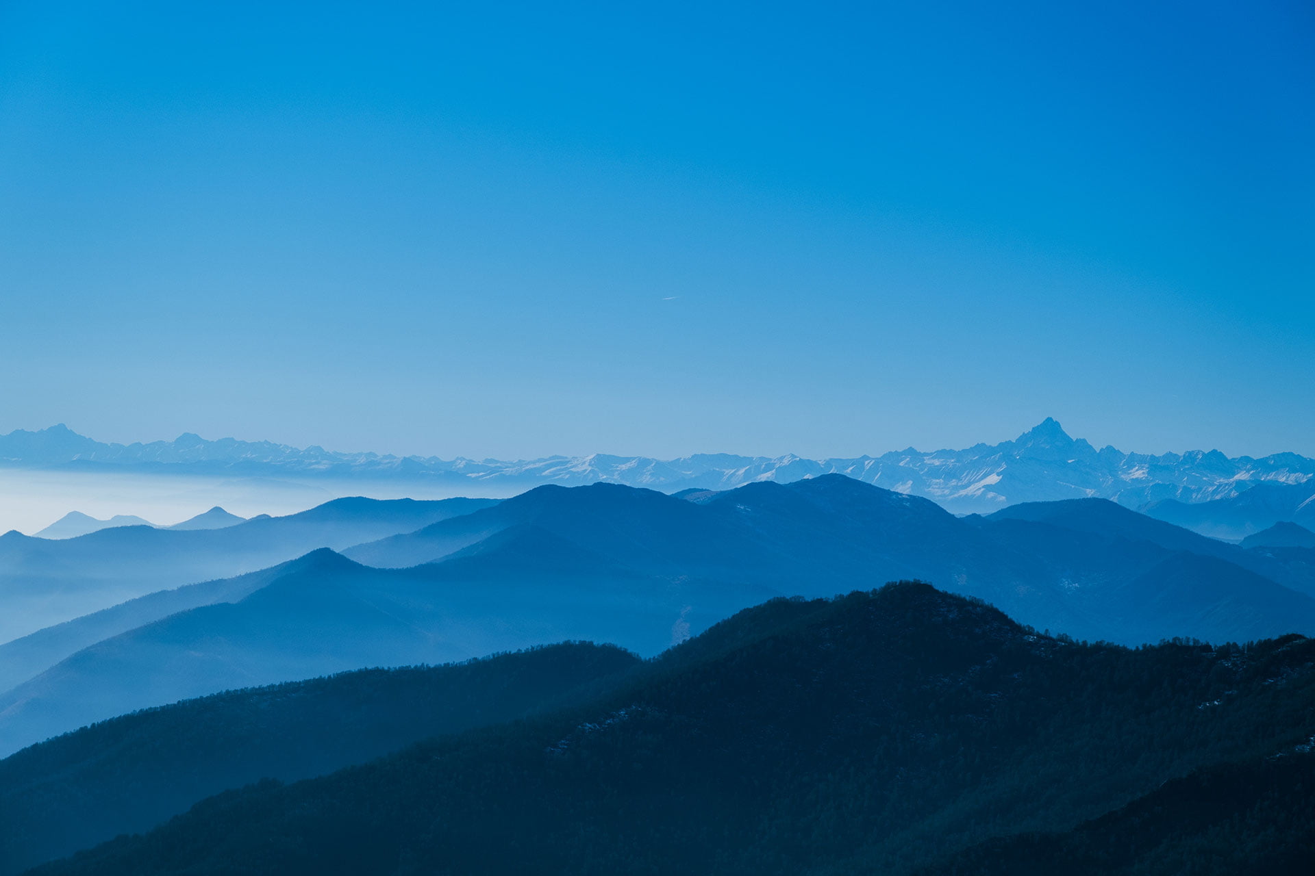
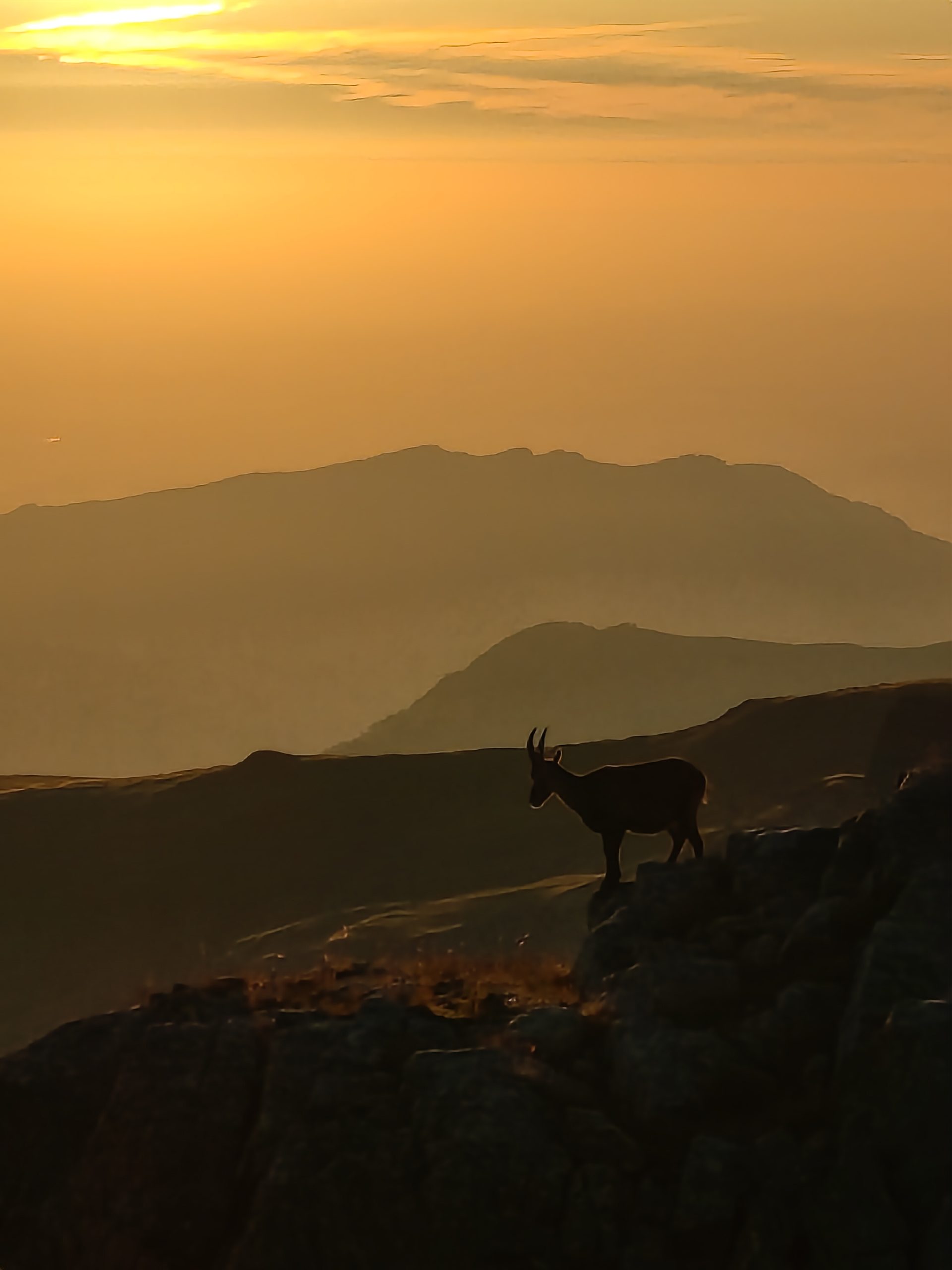
The region surrounding Monviso is like a time capsule, with stories of shepherds, pilgrims, and daredevil mountaineers who’ve ventured here over the centuries. The place boasts of everything an outdoor enthusiast could dream of – alpine lakes, lush meadows, and a vibrant tapestry of plants and critters.

Planning Our Monviso Extravaganza

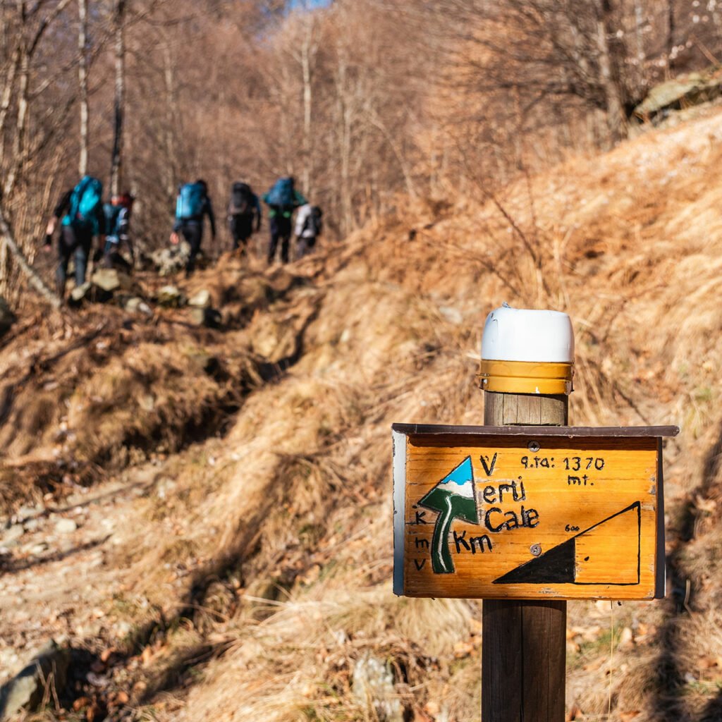
You can’t just wander into a place like Monviso without a plan. So, we huddled up and devised our three-day master plan. First things first, we parked our trusty car in Pian della Regina, a charming village snuggled in the Italian Alps, and embarked on our thrilling journey.

sunrise in rifugio sella monviso

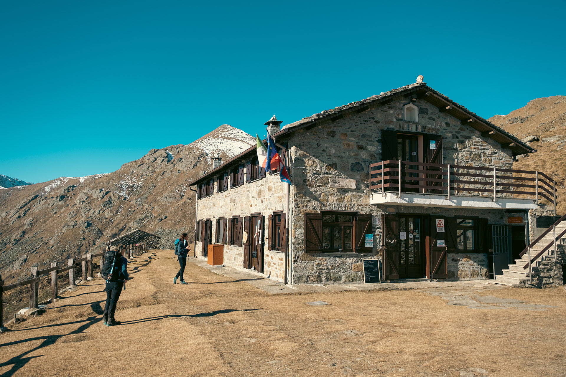
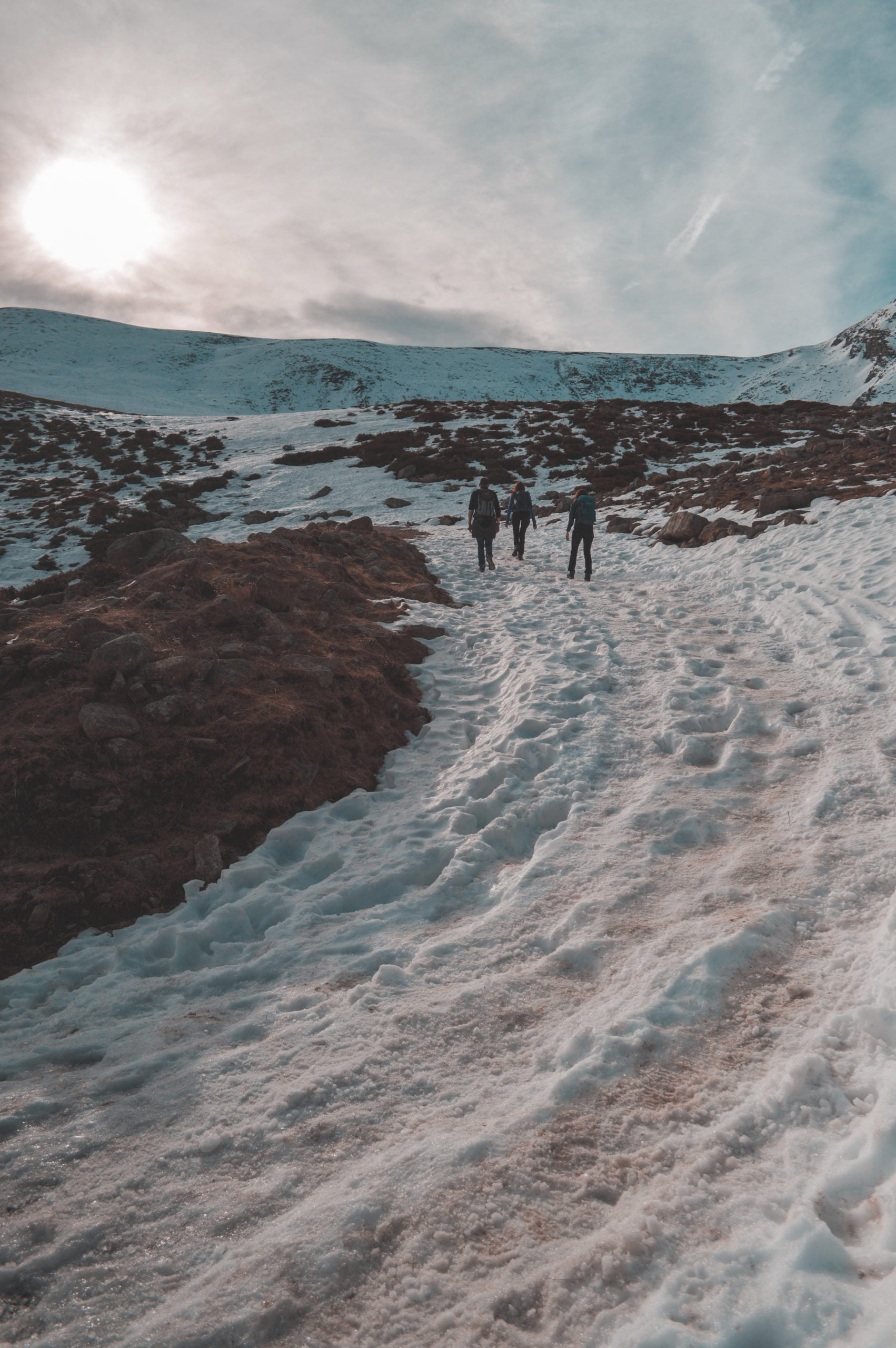
Day 1: Hello Rifugio Quintino Sella!

Our first day was all about the climb. We tackled a challenging 8.7-kilometer hike that saw us ascending 1,015 meters and descending 105 meters. With a moving time of four and a half hours, we finally reached Rifugio Quintino Sella at a lofty 2,644 meters. The fog played a little hide-and-seek with us, but the moment we caught glimpses of the breathtaking landscape, we knew it was worth it. Sadly, we had to skip those hot showers, but who needs ’em when you’re surrounded by mountain magic?

monviso from refugio sella

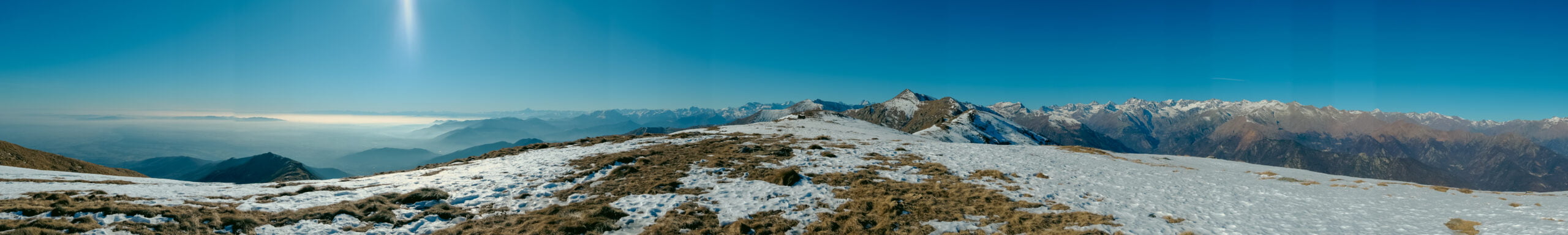
Day 2: Monviso Unveiled

The second day was an absolute stunner, with the sun gracing us with its presence. We trekked 15 kilometers, conquering an ascent of 800 meters and a descent of 1,000 meters. Rifugio Vallanta was our next stop, and while they, too, were shy with hot water, the sheer beauty of the Alpine scenery was all the luxury we needed.

monviso

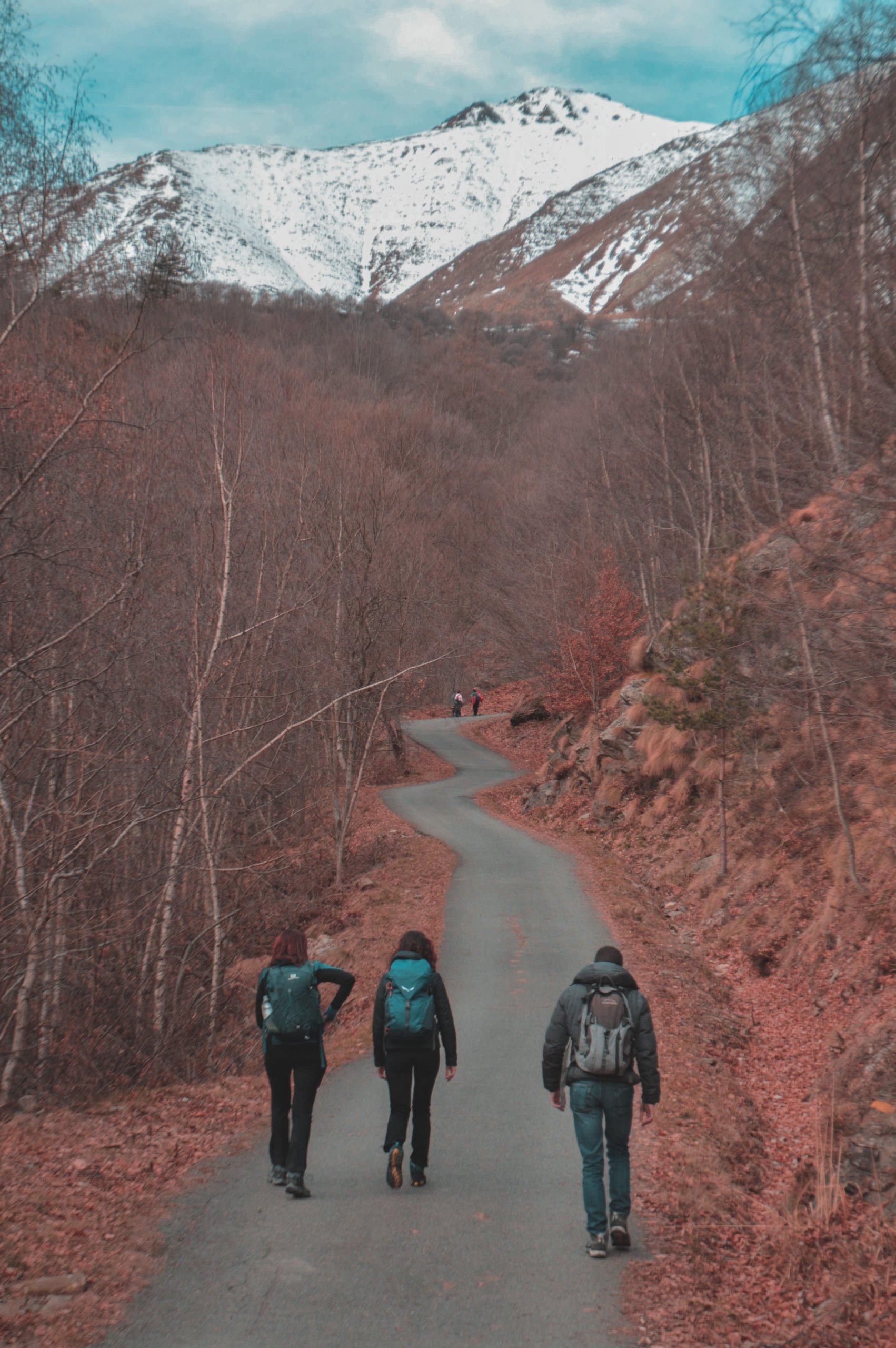
Day 3: Borders and Bocca del Viso

Our final day was a whirlwind of adventure. We made our way into France, treating our taste buds to some delectable local cuisine for lunch. Then, it was time for the pièce de résistance – the Bocca del Viso tunnel, connecting Italy and France. As we made our way back to Pian della Regina, we couldn’t help but feel grateful for the memories etched in our hearts.

In a nutshell, a Monviso tour is not just a physical adventure; it’s a soul-stirring journey that reconnects you with nature’s grandeur and weaves you into the fabric of history. This three-day escapade filled us with a profound appreciation for the Alpine wilderness, and the camaraderie we shared with friends made it all the more special. So, whether you’re seeking solitude, a dash of thrill, or just a healthy dose of mountain magic, Monviso has it all – and then some!

DSCF1326

Fénis Castle

Castello di Fénis 🇮🇹 or Fénis Castle 🇬🇧 or Château de Fénis 🇫🇷 is in Aosta Valley in the north-west of Italy. close to France and Switzerland borders. Aosta Valley or in Italian, Valle d’Aosta is the smallest and least populous region of Italy. But there are more than 30 castles in this small & beautiful region. Fénis Castle is one of the most famous one. it is well-known for its architecture and battlemented walls and the towers.

Location of Fénis Castle

The Castle is in the city of Fénis. it is just 13 km away from the city of Aosta. Fénis castle have many watchtowers which they linked together by walkway and protected with double boundary.

The courtyard, the centre of the central inhabited body, is the small quadrangular courtyard built by Bonifacio I between the end of the 14th and the beginning of the 15th century.

When you visit the castle it reminds you of Borgo medieval in Torino. do not get surprise. because the courtyard of Borgo medieval of Torino is a copy of the internal courtyard of the castle of Fénis.

Interior

Inside the castle there are numerous and gigantic fireplaces. I can imagine in the winter time the castle was pleasant and warm. they also using them for the cooking.

The rooms and balconies inside the courtyard are furnished with various types of wooden. this wood feeling made it elegant. The walls of the balconies are decorating with images of sages and prophets and proverbs in old French. You can visit first and second floor with chapel. The third floor, in the attic, was dedicated to the servant and is not visitable.

I visit the castle in beginning of the March. I am sure in the Spring it will be more beautiful when everything is green. If I have a chance, I will go there again in spring for taking better photos. maybe for the wallpaper section of my website. anyway, even visiting this castle in winter will be a good experience. if you are passing through Aosta valley you should stop there and visit this beautiful castle. you need one hour to visit the inside and then you can have a amazing lunch break at Aosta.

DSCF1160

San Fruttuoso, Portofino, Santa Margherita

Yes, Everybody knows Portofino is astonishing but, did you know that there is marvellous place after that which you can not reach there by car? San Fruttuoso! We did a trekking from Santa Margherita through Portofino until San Fruttuoso, and it was far behind that perfect.

Start Point

Santa Margherita

Santa Margherita was always one of my favourite city in Liguria region of Italy. Portofino is very famous among foreigners but in fact in my opinion Santa Margherita Liguria is a demo of heaven on the earth. Amazing sea with mesmerising rocks stick to the green hills which the eyes cannot stop enjoy watching them. Since I moved to Italy every summer, I had remarkable memories over there. Unforgettable and Fancy at the same time. Luckily, I live so close to them, and I’ve been plenty of times there. But, the outstanding fact about Italy is that there are always new places, new foods, new wines, new cheeses &… to surprise you.

To Portofino

Portofino

We parked the car near the train station of Santa Margherita to start our journey. It was February and even not spring yet. But finding a parking over there is not always easy and will be costly too. If you can reach there by The train, do not take your car. We walked alongside the sea to reach Portofino. This fantastic place. Luckily, I took numerous photos because words cannot describe the beauty of it.

San Fruttuoso

San Fruttuoso

When you reach Portofino, it is almost the end, and usually, you can not go further. But if you like trekking, you can find a way through the mountains to reach San Fruttuoso in 2 hours with normal pace. The passage is wonderful with eye-catching view to the cliffs and sea. I saw a man living and working on his farm, 5 minutes away from one of the most expensive places of the world. Far away from all those yacht and fancy cars. I really believe he was the richest man over there.

We walked totally 25 km and with elevation gain of around 1000 m. On the way back, we took the bus from Portofino back to Santa Margherita train station because we were exhausted and why not!

You can find Strava activity of this day here. if you have a plan to visit Portofino I highly suggest you to take your time and do the trekking to San Fruttuoso too.

P. S: every time after I posted photos that I’ve taken as stories on instagram, many people replied and told me that they made a screenshot to use the photo as their wallpaper. It makes me delighted that people liked my photos that much. But, I prefer they use the high-quality one. So soon I will put a wallpaper download section on my website for selected wallpapers. So, you can download my photos in high-quality format for the wallpaper. so look for it later in my website menu and let me know if you also use them as your wallpaper. it really motivates me.

I Giorni della Merla

Last weekend for I Giorni della Merla we decided to go to Belavarda near the city of Cantoira in Piemonte. OK, but what the heck is I Giorni della Merla? Continue reading this post to know…

To Begin

Although it was I Giorni della Merla but it was a really hot sunny day. We start our journey from Lities. A small village which you start directly from there or even if you are ready for 400 m more height difference you can even start from Cantoira. All the information of this route completely described here. Yes, it is in Italian, but you can always use translator. These days they are working much smarter even with a hard language like the Italian.

panormaic View from Bellavarda

The Accident

Once again, our plan was going on our own. And yes, as I mentioned before in our journey to Monte Soglio I always prefer more adventure and taking more risks. But to be honest on this trip we got lost which for me was still fine, and then an accident happened to one of my friend, and he slipped and fell down from the cliff. Frankly, we were so lucky that he did not get any serious injury. But I understand that we need to be more careful and also get more prepared for unwanted incidents.

The Second Accident

The other things that happened on this trip was after that accident we finally reached somewhere to had our meal, and then I just discovered that I left my delicious Tuna Avocado sandwiches in the fridge! Luckily, I was not that hungry at the moment. Later on that night I had a big Burger plus lots of fried stuff as a reward to myself.

The Details

This trekking include a really steep track which require a good level of fitness. So, I do not recommend it for beginners. The total distance to the summit is around 4.5 km, but the height difference is around 1000 m and if you start from Cantoira it will be 400 m more. The path almost well signposted, but be careful because we got lost of the track two times. There are some signs which also let you know the vertical distance which you take so far in an interesting graphical way. You can see it in photos at the end of this post.

I Giorni della Merla

The last 3 days of January (from the 29th to the 31st) are traditionally called “I Giorni della Merla” (Blackbird’s Days) and are considered the coldest days of the year. This is actually just a legend, but I am crazy for these types of legends.

I giorni della merla
Merla (Black bird)

The origin of the saying

There are numerous theories about the origin of the expression “I Giorni della Merla”. Which you can find them by yourself or just ask your Italian friends about it.

But according to my favourite legend, January originally had 28 days. The month of January was terrible to a poor blackbird because he envied her beautiful pure white plumage. Every time this poor bird went out seeking food for herself and her little ones, the Month became suddenly colder. Tired of this, one year, the blackbird decided to gather enough supplies for the whole month. When, after the 28th day, she went out singing and mocking January because she thought she had played him, January got upset and borrowed three extra days from his brother February so that it could continue to torment the blackbird with snowstorms, chill, wind, and rain. During those days, the blackbird was out hunting for food and had to find shelter into a chimney; when she came out, three days later, her plumage was black. Since then, blackbirds have always been black and January has 31 days.

If you check my instagram post of this trip you will see me mostly with short sleeves and that is why maybe it is all just a legend. If you are Italian and know any other origin about I Giorni della Merla, please let me know about it.

MonteSoglio

Monte Soglio

Monte Soglio is a 1971 m mountain belonging to Graian Alps (Alpi Graie). Graian Alps is a section of the Alps located between Italy, France & Switzerland. The west part of the Alps which you all know, the most famous and highest peak of it: the famous Mont Blanc.
It seems finally my Italian friends start to believe that we do not need the guide for every easy trekking route. Frankly, for me (who did the Damavand (5600 m) without any guide only with a friend who she is also was completely noob like me) understanding that why we always require a guide here is a little hard. Yes, I absolutely appreciate group trekking and meeting new people and making friends. Plus that there are numerous adventures route or new experiences that it’s much safer with a proper guide. But come on, here there are full of sign always on the route which you do not even need to use maps and routes on your phone.

Monte Soglio

Starting point

Any way, we decided to hike to Monte Soglio from Piano Audi. Piano Audi is straightforward access by car. Then you can start your journey to Monte Soglio summit exactly from there. The distance we did was around 15 km and the difference in the altitude of around 1000 m.

Alpe Soglia Refuge near Monte Soglio

Monte Soglio


Near the summit you will reach the Alpe Soglia Refuge which was really nice like all the other Refuge in the mountains.
We did this route on 22nd of Jan and there was only a little part covered with snow and glacier. You will not need snowshoes, but maybe having crampons make the passage to the summit more pleasant. (Which I did not have!)

Monte Soglio

The summit had the amazing 360º view which was really delightful. I am still a little lazy to organise my gallery system here and post photos there. So for the moment I will add some selected photos to the post gallery.

Fontana Mura

Fontana Mura

If you are looking for easy hiking/trekking in Piemonte, Fontana Mura is the one.

We were looking for an easy weekend half-day trekking and we decided to go to Fontana Mura refuge. The Fontana Mura refuge is located inside the Orsiera-Rocciavrè nature park, at the foot of the Colle Della Roussa, a pass that connects Val Sanguine with Val Chisone. The refuge takes its name from the source of the Sangone river, (originally Fontana Moura) that flows near the structure. It is located at 1726 m above sea level and is located in Alpe Sellery Superiore, and can only be reached on foot or by mountain bike from the start of the road-agro-silvo-pastorale near the town of Pian Neiretto, after Forno di Coazze.

starting point to fontana mura refuge

to start you can park your car here and start walking from here. the distance to Fontana mura refuge is about 7km and with an elevation gain of around 600m. you can find my activity of it on Strava. if you are looking for an easy hike or if you just want to start hiking it is a really nice choice.

fonta mura

if you are going there in the winter season prepare yourself with proper shoes and gear for walking in the snow and ice. at the end, you will arrive at the Fontana Mura refuge. you can continue the route from there or come back to your starting point. but I highly recommend you to try foods and drink in the refuge.

Fontana Mura Refuge

on the way back there is another refuge which is totally different and is located in lower altitude with more trees surrounding it. if you have time you can visit that too.

I will try to continue posting more about locations in my blog. but honestly writing is something that I did not do it so often recently but I promise to do my best. if this post was useful for you please write a comment or share it with your friends.

Also, I made a reel on my Instagram about this trip. take a look at it here