MonteSoglio

Monte Soglio

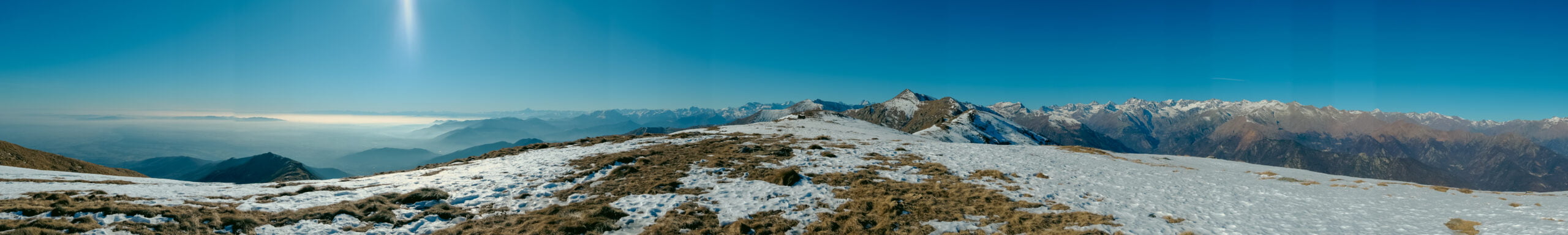
Monte Soglio is a 1971 m mountain belonging to Graian Alps (Alpi Graie). Graian Alps is a section of the Alps located between Italy, France & Switzerland. The west part of the Alps which you all know, the most famous and highest peak of it: the famous Mont Blanc.
It seems finally my Italian friends start to believe that we do not need the guide for every easy trekking route. Frankly, for me (who did the Damavand (5600 m) without any guide only with a friend who she is also was completely noob like me) understanding that why we always require a guide here is a little hard. Yes, I absolutely appreciate group trekking and meeting new people and making friends. Plus that there are numerous adventures route or new experiences that it’s much safer with a proper guide. But come on, here there are full of sign always on the route which you do not even need to use maps and routes on your phone.

Monte Soglio

Starting point

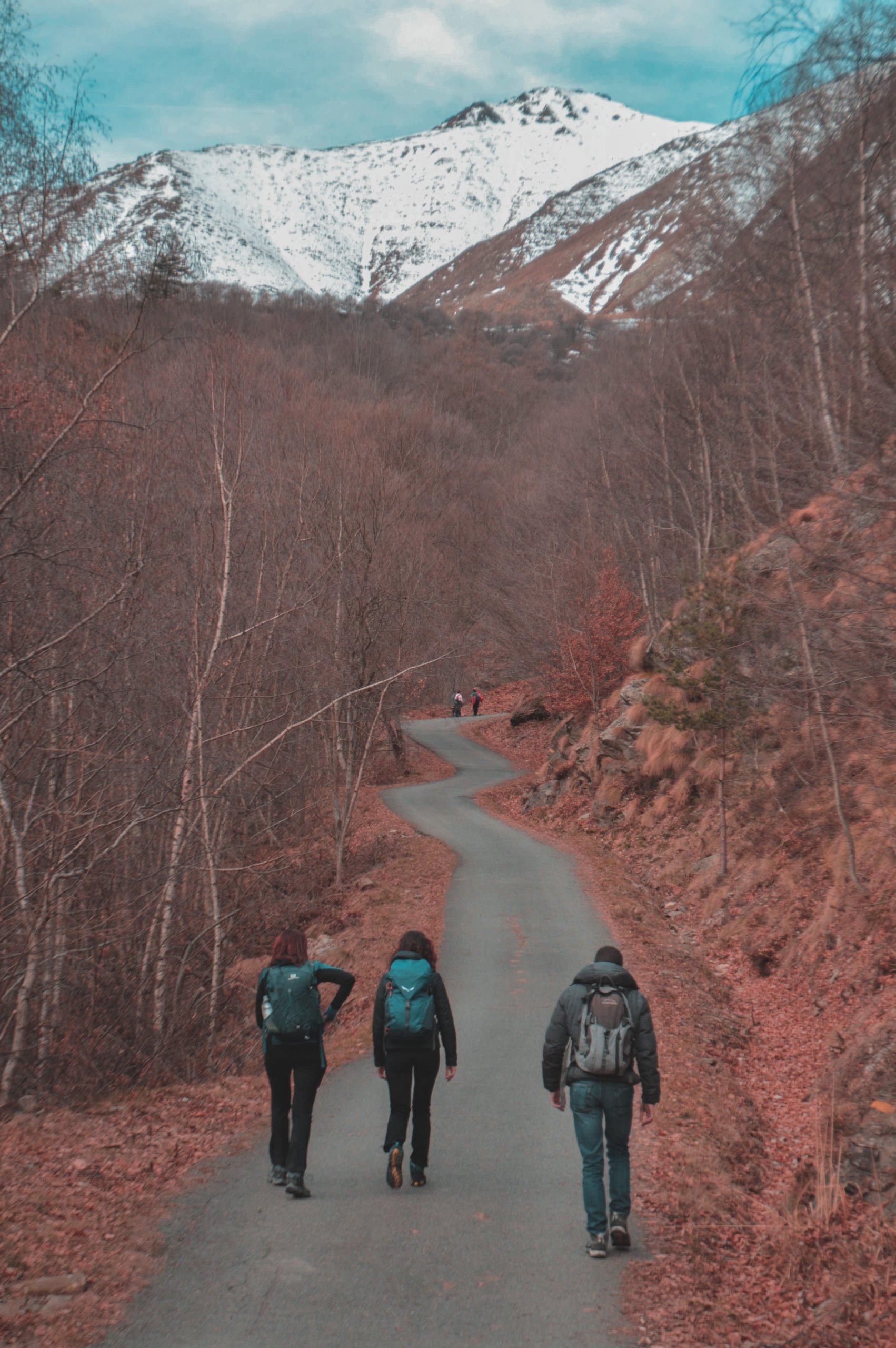
Any way, we decided to hike to Monte Soglio from Piano Audi. Piano Audi is straightforward access by car. Then you can start your journey to Monte Soglio summit exactly from there. The distance we did was around 15 km and the difference in the altitude of around 1000 m.

Alpe Soglia Refuge near Monte Soglio

Monte Soglio


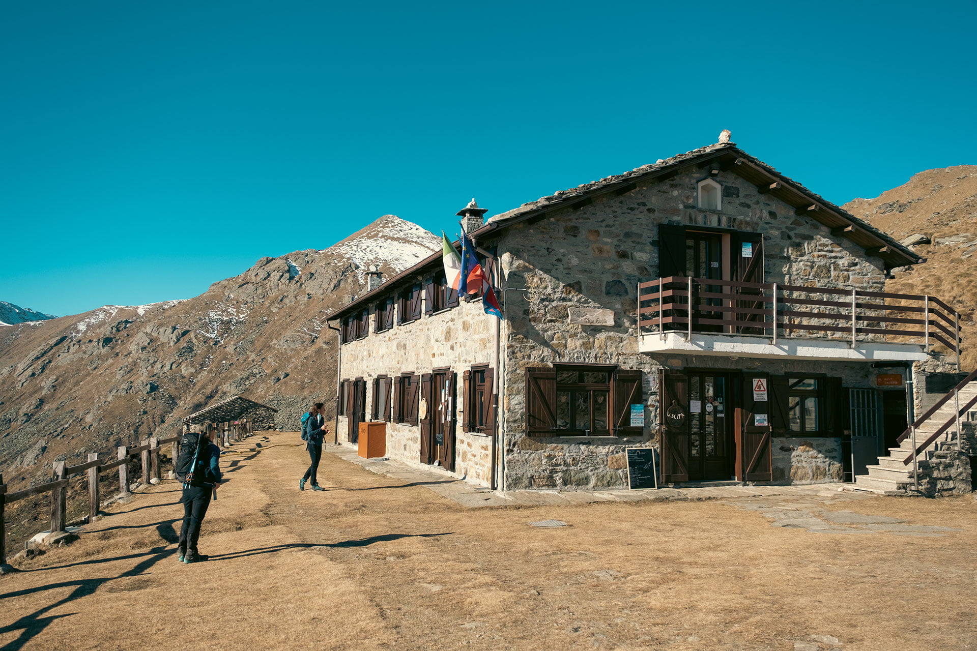
Near the summit you will reach the Alpe Soglia Refuge which was really nice like all the other Refuge in the mountains.
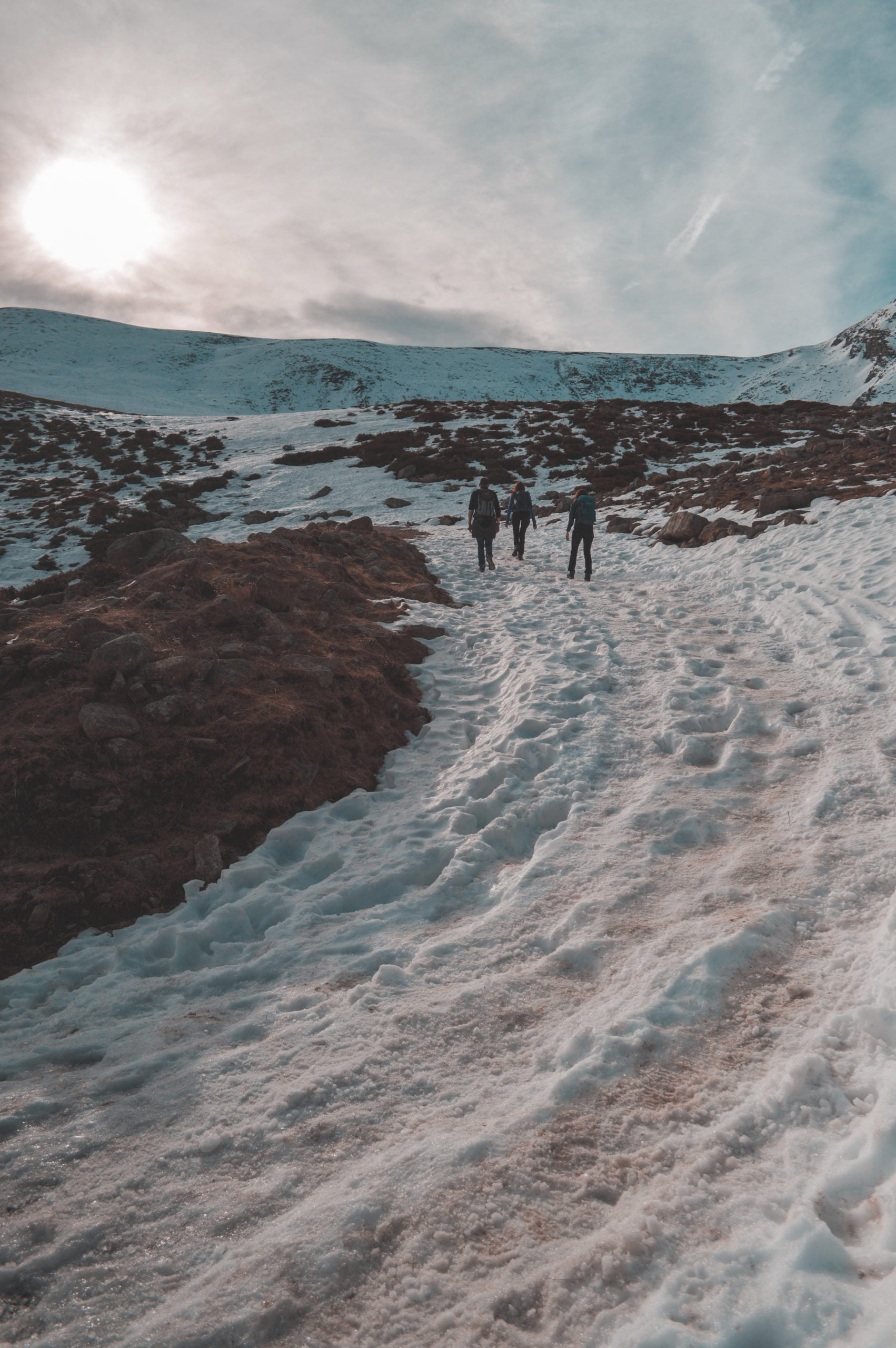
We did this route on 22nd of Jan and there was only a little part covered with snow and glacier. You will not need snowshoes, but maybe having crampons make the passage to the summit more pleasant. (Which I did not have!)

Monte Soglio

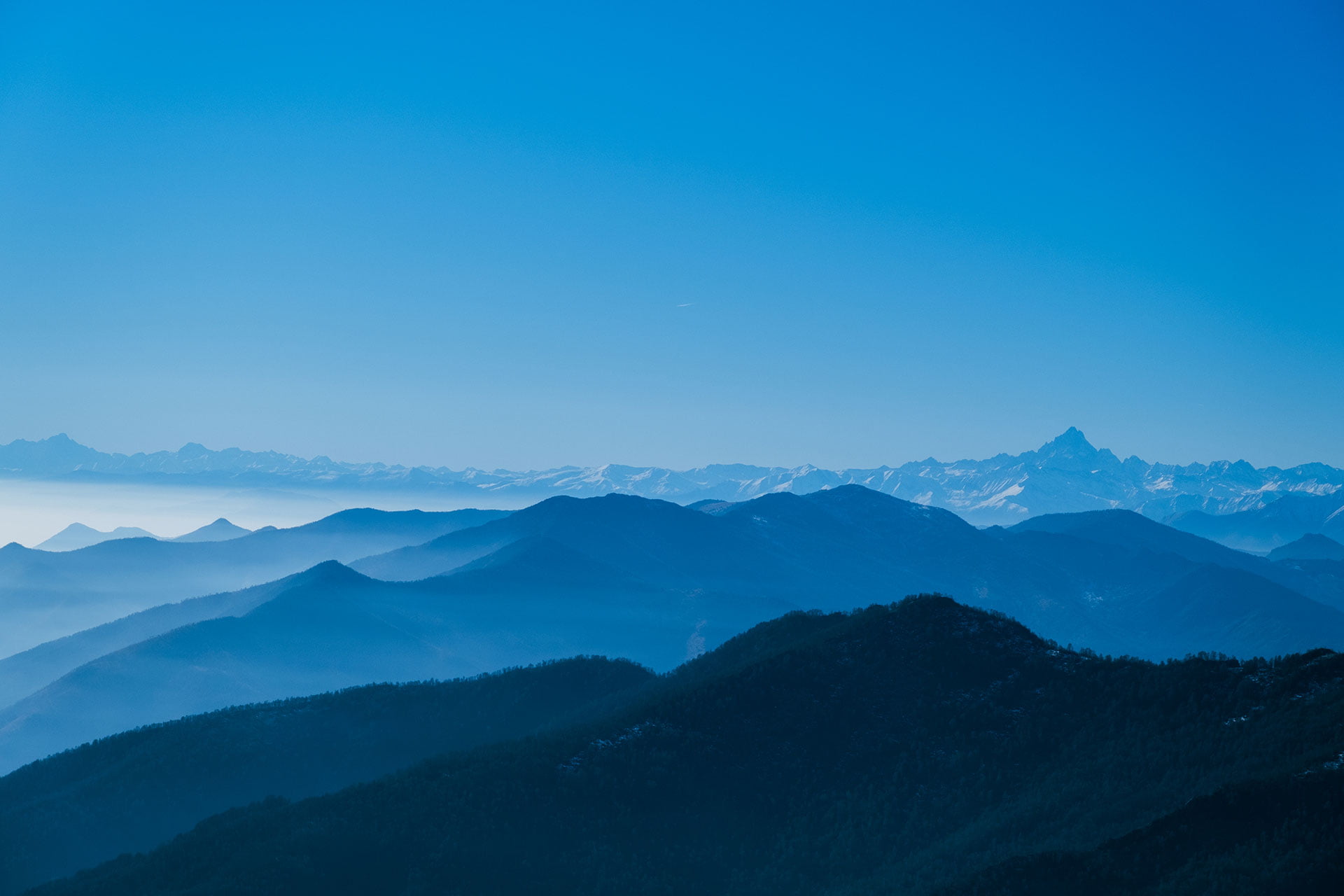
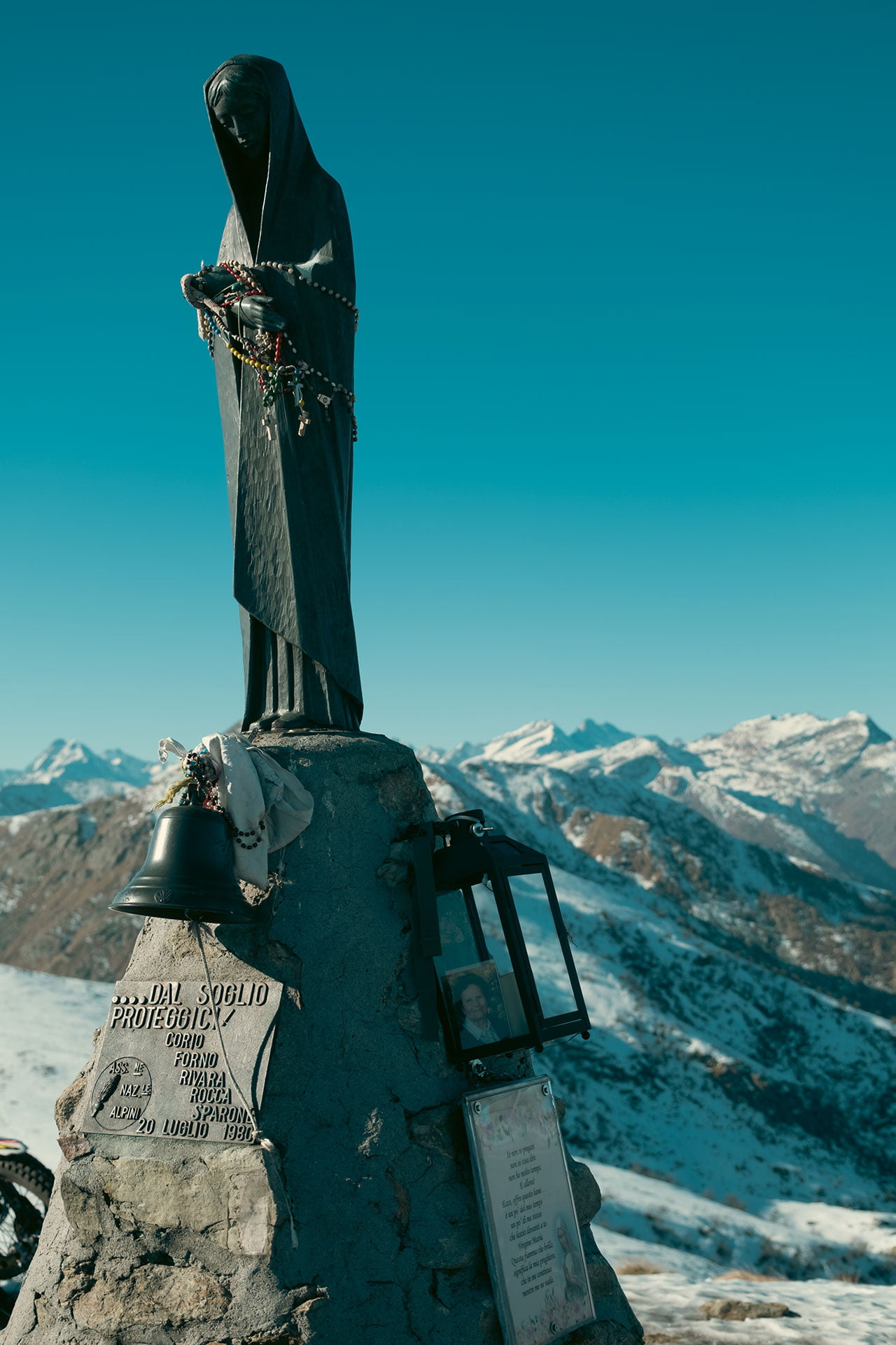
The summit had the amazing 360º view which was really delightful. I am still a little lazy to organise my gallery system here and post photos there. So for the moment I will add some selected photos to the post gallery.

Fontana Mura

Fontana Mura

If you are looking for easy hiking/trekking in Piemonte, Fontana Mura is the one.

We were looking for an easy weekend half-day trekking and we decided to go to Fontana Mura refuge. The Fontana Mura refuge is located inside the Orsiera-Rocciavrè nature park, at the foot of the Colle Della Roussa, a pass that connects Val Sanguine with Val Chisone. The refuge takes its name from the source of the Sangone river, (originally Fontana Moura) that flows near the structure. It is located at 1726 m above sea level and is located in Alpe Sellery Superiore, and can only be reached on foot or by mountain bike from the start of the road-agro-silvo-pastorale near the town of Pian Neiretto, after Forno di Coazze.

starting point to fontana mura refuge

to start you can park your car here and start walking from here. the distance to Fontana mura refuge is about 7km and with an elevation gain of around 600m. you can find my activity of it on Strava. if you are looking for an easy hike or if you just want to start hiking it is a really nice choice.

fonta mura

if you are going there in the winter season prepare yourself with proper shoes and gear for walking in the snow and ice. at the end, you will arrive at the Fontana Mura refuge. you can continue the route from there or come back to your starting point. but I highly recommend you to try foods and drink in the refuge.

Fontana Mura Refuge

on the way back there is another refuge which is totally different and is located in lower altitude with more trees surrounding it. if you have time you can visit that too.

I will try to continue posting more about locations in my blog. but honestly writing is something that I did not do it so often recently but I promise to do my best. if this post was useful for you please write a comment or share it with your friends.

Also, I made a reel on my Instagram about this trip. take a look at it here